
Jiangxi topographic map
Interactive map
Click on the map to display elevation.
About this map
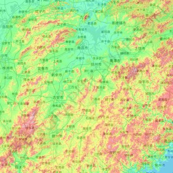
Name: Jiangxi topographic map, elevation, terrain.
Location: Jiangxi, China (24.48885 113.57490 30.07999 118.48216)
Average elevation: 327 m
Minimum elevation: -1 m
Maximum elevation: 2,037 m
Other topographic maps
Click on a map to view its topography, its elevation and its terrain.