
Thank you for supporting this site ❤️
Make a donation
Make a donation
Lough Neagh topographic map
Click on the map to display elevation.
Thank you for supporting this site ❤️
Make a donation
Make a donation
About this map
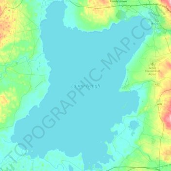
Name: Lough Neagh topographic map, elevation, terrain.
Location: Lough Neagh, County Antrim, Northern Ireland, United Kingdom (54.48594 -6.60911 54.75142 -6.22978)
Average elevation: 29 m
Minimum elevation: 8 m
Maximum elevation: 170 m
Thank you for supporting this site ❤️
Make a donation
Make a donation
Other topographic maps
Click on a map to view its topography, its elevation and its terrain.
Thank you for supporting this site ❤️
Make a donation
Make a donation
Thank you for supporting this site ❤️
Make a donation
Make a donation