
Thank you for supporting this site ❤️
Make a donation
Make a donation
Lake Borumba topographic map
Click on the map to display elevation.
Thank you for supporting this site ❤️
Make a donation
Make a donation
About this map
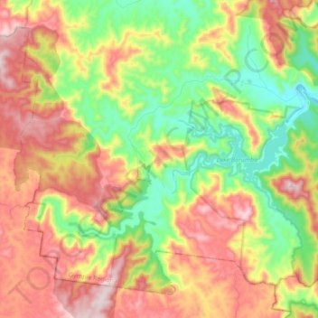
Name: Lake Borumba topographic map, elevation, terrain.
Location: Lake Borumba, Gympie Regional, Queensland, Australia (-26.58848 152.43516 -26.45807 152.60631)
Average elevation: 331 m
Minimum elevation: 98 m
Maximum elevation: 603 m
Thank you for supporting this site ❤️
Make a donation
Make a donation
Other topographic maps
Click on a map to view its topography, its elevation and its terrain.