
Lüneburg topographic map
Interactive map
Click on the map to display elevation.
About this map
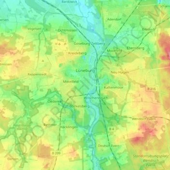
Name: Lüneburg topographic map, elevation, terrain.
Location: Lüneburg, Lower Saxony, Germany (53.19184 10.33083 53.28664 10.51436)
Average elevation: 37 m
Minimum elevation: 5 m
Maximum elevation: 85 m