
Mandelbachtal topographic map
Interactive map
Click on the map to display elevation.
About this map
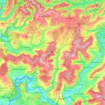
Name: Mandelbachtal topographic map, elevation, terrain.
Location: Mandelbachtal, Saarpfalz-Kreis, Sarre, 66399, Allemagne (49.12041 7.10087 49.25038 7.20311)
Average elevation: 294 m
Minimum elevation: 195 m
Maximum elevation: 398 m