
Gustav-Comberg-Park topographic map
Interactive map
Click on the map to display elevation.
About this map
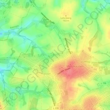
Name: Gustav-Comberg-Park topographic map, elevation, terrain.
Average elevation: 153 m
Minimum elevation: 118 m
Maximum elevation: 187 m
Other topographic maps
Click on a map to view its topography, its elevation and its terrain.
Obschwarzbach
Deutschland > Nordrhein-Westfalen > Kreis Mettmann > Mettmann
Obschwarzbach, Mettmann, Kreis Mettmann, Nordrhein-Westfalen, 40822, Deutschland
Average elevation: 160 m