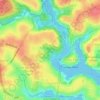
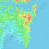
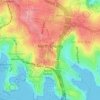
Lady Bay topographic map
Click on the map to display elevation.
About this map

Name: Lady Bay topographic map, elevation, terrain.
Location: Lady Bay, Sydney, New South Wales, 2030, Australia (-33.83504 151.27879 -33.83494 151.27889)
Average elevation: 3 m
Minimum elevation: 0 m
Maximum elevation: 68 m
Other topographic maps
Click on a map to view its topography, its elevation and its terrain.


Wentworth Falls
Australia > New South Wales > Sydney
Wentworth Falls (postcode: 2782) is a town in the Blue Mountains region of New South Wales, situated approximately 100 kilometres (62 mi) west of the Sydney central business district, and about 8 kilometres (5.0 mi) east of Katoomba, Australia on the Great Western Highway, with a Wentworth Falls railway…
Average elevation: 708 m






Casula
Australia > New South Wales > Sydney
Casula is the first suburb immediately south of Liverpool on the Hume Highway and the Main Southern railway line between Sydney and Melbourne. Casula consists of undulating, gently rolling land, with elevations across the suburb being mostly between 30 and 70 metres above sea level. The Georges River forms the…
Average elevation: 34 m


Penrith
Australia > New South Wales > Sydney > Penrith
Penrith is a city in New South Wales, Australia, located in Greater Western Sydney, 55 kilometres (31 mi) west of the Sydney central business district on the banks of the Nepean River, on the outskirts of the Cumberland Plain. Its elevation is 32 metres (105 ft).
Average elevation: 34 m




Woronora
Australia > New South Wales > Sydney
Woronora Plateau, is a geographical region adjacent to the Sydney Plain. Slightly higher in altitude, it is capped with Hawkesbury Sandstone. The Woronora River flows through the deeply dissected plateau to the Georges River from near the sources of the Port Hacking, within the Sutherland Shire.
Average elevation: 65 m












Thornleigh
Australia > New South Wales > Sydney
Thornleigh is bounded to the north by Waitara Creek and south by the Lane Cove National Park. Thornleigh borders the suburbs of Normanhurst, Hornsby, Wahroonga, Westleigh and Pennant Hills. Thornleigh offers great district views, and the topography varies greatly with many established areas built around…
Average elevation: 159 m