
Röschenz topographic map
Interactive map
Click on the map to display elevation.
About this map
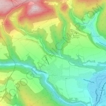
Name: Röschenz topographic map, elevation, terrain.
Location: Röschenz, Bezirk Laufen, Basel-Landschaft, 4244, Schweiz (47.41267 7.43784 47.45144 7.48508)
Average elevation: 518 m
Minimum elevation: 351 m
Maximum elevation: 794 m
Other topographic maps
Click on a map to view its topography, its elevation and its terrain.
Bueberg
Schweiz > Basel-Landschaft > Bezirk Laufen > Laufen
Bueberg, Laufen, Bezirk Laufen, Basel-Landschaft, 4242, Schweiz
Average elevation: 495 m