
Fouhren topographic map
Interactive map
Click on the map to display elevation.
About this map
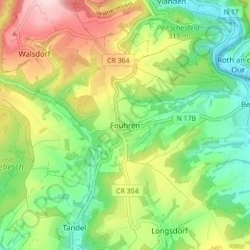
Name: Fouhren topographic map, elevation, terrain.
Location: Fouhren, Tandel, Canton Vianden, 9454, Luxembourg (49.89380 6.17512 49.93380 6.21512)
Average elevation: 308 m
Minimum elevation: 196 m
Maximum elevation: 481 m