
Thank you for supporting this site ❤️
Make a donation
Make a donation
Dimas topographic map
Click on the map to display elevation.
Thank you for supporting this site ❤️
Make a donation
Make a donation
About this map
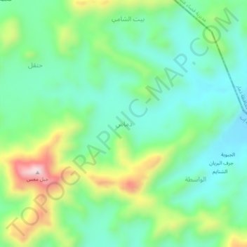
Name: Dimas topographic map, elevation, terrain.
Location: Dimas, Yarim District, Ibb Governorate, Yemen (14.30638 44.41000 14.34638 44.45000)
Average elevation: 2,583 m
Minimum elevation: 2,433 m
Maximum elevation: 2,924 m
Thank you for supporting this site ❤️
Make a donation
Make a donation
Other topographic maps
Click on a map to view its topography, its elevation and its terrain.