
Make a donation
Siegquelle topographic map
Click on the map to display elevation.
Make a donation
Siegquelle
Wenige Meter westlich der Siegquelle verläuft die Eisenstraße des Rothaargebirges (Landesstraße 722; Lützel–Lahnhof), die 170 Straßenmeter weiter nordwestlich auf 596,2 m Höhe die L 719 (Großenbach–Walpersdorf) kreuzt. Keine 100 m östlich der Kreuzung liegt ein Parkplatz. Direkt vorbei an der Quelle führt der Rothaarsteig. In Zukunft soll die Quelle auch an den Natursteig Sieg angebunden werden.
Make a donation
About this map
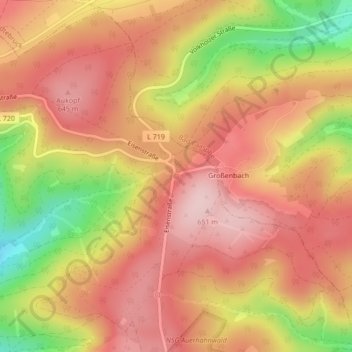
Name: Siegquelle topographic map, elevation, terrain.
Average elevation: 576 m
Minimum elevation: 430 m
Maximum elevation: 659 m
Make a donation
Other topographic maps
Click on a map to view its topography, its elevation and its terrain.
Oelgershausen
Deutschland > Nordrhein-Westfalen > Kreis Siegen-Wittgenstein > Netphen
Average elevation: 350 m
Helgersdorf
Deutschland > Nordrhein-Westfalen > Kreis Siegen-Wittgenstein > Netphen
Average elevation: 414 m
Unglinghausen
Deutschland > Nordrhein-Westfalen > Kreis Siegen-Wittgenstein > Netphen
Average elevation: 371 m
Grissenbach
Deutschland > Nordrhein-Westfalen > Kreis Siegen-Wittgenstein > Netphen
Average elevation: 409 m
Make a donation
Salchendorf
Deutschland > Nordrhein-Westfalen > Kreis Siegen-Wittgenstein > Netphen
Die Bebauung des Orts befindet sich auf einer Höhe zwischen 330 und 390 m ü. NHN. Die Gemarkung Salchendorf hat eine Fläche von 9,2 km². Berge und Erhebungen um Salchendorf sind unter anderem Heinenberg 530,7 m, Rübenhain, Auf der Noll mit 474,1 m und der Haferhain mit 503,5 m Höhe. Durch den Ort fließt…
Average elevation: 403 m
Werthenbach
Deutschland > Nordrhein-Westfalen > Kreis Siegen-Wittgenstein > Netphen
Average elevation: 489 m
Hainchen
Deutschland > Nordrhein-Westfalen > Kreis Siegen-Wittgenstein > Netphen
Hainchen liegt am Ostrand des historischen Siegerlandes, an der Nahtstelle der Quellmuldenlandschaft des naturräumlichen Siegerlandes zum Rothaargebirge. Die nach dem Ort benannte Haincher Höhe, die die Ortslage unmittelbar östlich um rund 200 m überragt, stellt einen gratartigen Südwestausläufer des…
Average elevation: 485 m
Nenkersdorf
Deutschland > Nordrhein-Westfalen > Kreis Siegen-Wittgenstein > Netphen > Nenkersdorf
Average elevation: 486 m
Make a donation
Sohlbach
Deutschland > Nordrhein-Westfalen > Kreis Siegen-Wittgenstein > Netphen > Sohlbach
Average elevation: 491 m