
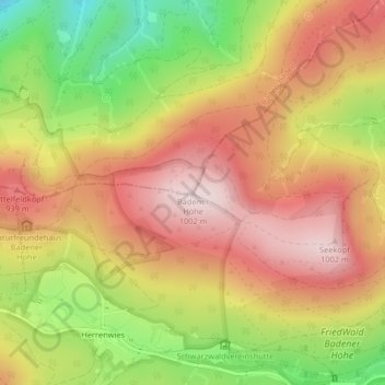
Badener Höhe topographic map
Interactive map
Click on the map to display elevation.
About this map
Name: Badener Höhe topographic map, elevation, terrain.
Average elevation: 822 m
Minimum elevation: 585 m
Maximum elevation: 1,001 m
Other topographic maps
Click on a map to view its topography, its elevation and its terrain.
Herrenwies
Deutschland > Baden-Württemberg > Landkreis Rastatt > Forbach
Herrenwies, Forbach, Landkreis Rastatt, Baden-Württemberg, Deutschland
Average elevation: 849 m
Streitmannskopf
Deutschland > Baden-Württemberg > Landkreis Rastatt > Forbach
Streitmannskopf, Forbach, Landkreis Rastatt, Baden-Württemberg, 76596, Deutschland
Average elevation: 776 m