
Lens topographic map
Interactive map
Click on the map to display elevation.
About this map
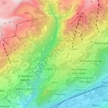
Name: Lens topographic map, elevation, terrain.
Location: Lens, Sierre, Valais/Wallis, 3960, Suíça (46.25920 7.42772 46.34629 7.48957)
Average elevation: 1,390 m
Minimum elevation: 499 m
Maximum elevation: 2,839 m