
Aïn Ouksir topographic map
Interactive map
Click on the map to display elevation.
About this map
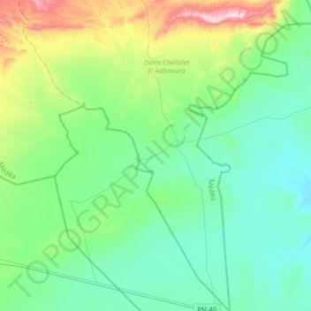
Name: Aïn Ouksir topographic map, elevation, terrain.
Location: Aïn Ouksir, Daïra Chellalet El Adhaoura, Médéa, Algérie (35.65139 3.33833 35.90090 3.60003)
Average elevation: 722 m
Minimum elevation: 607 m
Maximum elevation: 1,135 m
Other topographic maps
Click on a map to view its topography, its elevation and its terrain.
Zaatria
Algérie > Médéa > Daïra Chellalet El Adhaoura
Zaatria, Tafraout, Daïra Chellalet El Adhaoura, Médéa, Algérie
Average elevation: 1,092 m
Cheniguel
Algérie > Médéa > Daïra Chellalet El Adhaoura
Cheniguel, Daïra Chellalet El Adhaoura, Médéa, Algérie
Average elevation: 843 m