
La Fosserie topographic map
Interactive map
Click on the map to display elevation.
About this map
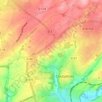
Name: La Fosserie topographic map, elevation, terrain.
Average elevation: 95 m
Minimum elevation: 16 m
Maximum elevation: 151 m
Other topographic maps
Click on a map to view its topography, its elevation and its terrain.
L'Écoulanderie
France > Normandie > Manche > Coutances
L'Écoulanderie, Coutances, Manche, Normandie, France métropolitaine, 50200, France
Average elevation: 89 m