
Gefell topographic map
Interactive map
Click on the map to display elevation.
About this map
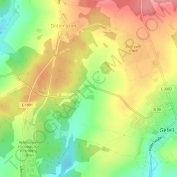
Name: Gefell topographic map, elevation, terrain.
Location: Gefell, Saale-Orla-Kreis, Thüringen, 07926, Deutschland (50.44419 11.84092 50.44429 11.84102)
Average elevation: 582 m
Minimum elevation: 527 m
Maximum elevation: 633 m