
Montesano topographic map
Interactive map
Click on the map to display elevation.
About this map
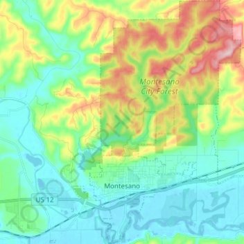
Name: Montesano topographic map, elevation, terrain.
Location: Montesano, Grays Harbor County, Washington, USA (46.96101 -123.63940 47.04560 -123.54218)
Average elevation: 65 m
Minimum elevation: -4 m
Maximum elevation: 224 m