
Comercial topographic map
Interactive map
Click on the map to display elevation.
About this map
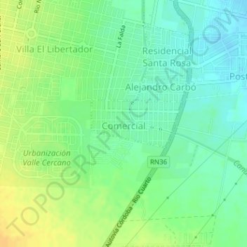
Name: Comercial topographic map, elevation, terrain.
Average elevation: 462 m
Minimum elevation: 450 m
Maximum elevation: 476 m
Other topographic maps
Click on a map to view its topography, its elevation and its terrain.
Villa Serrana
Villa Serrana, Córdova, Municipio de Córdoba, Pedanía Capital, Departamento Capital, Córdova, X5022, Argentina
Average elevation: 463 m