
Cantemerle topographic map
Interactive map
Click on the map to display elevation.
About this map
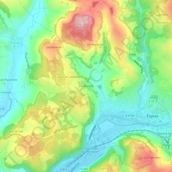
Name: Cantemerle topographic map, elevation, terrain.
Average elevation: 265 m
Minimum elevation: 186 m
Maximum elevation: 390 m
Other topographic maps
Click on a map to view its topography, its elevation and its terrain.
La Montagnette
France > Occitanie > Lot > Figeac
La Montagnette, Figeac, Lot, Occitanie, France métropolitaine, 46100, France
Average elevation: 306 m
Le Cingle-Haut
France > Occitanie > Lot > Figeac
Le Cingle-Haut, Figeac, Lot, Occitanie, France métropolitaine, 46100, France
Average elevation: 270 m