
Thank you for supporting this site ❤️
Make a donation
Make a donation
Steele topographic map
Click on the map to display elevation.
Thank you for supporting this site ❤️
Make a donation
Make a donation
About this map
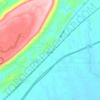
Name: Steele topographic map, elevation, terrain.
Location: Steele, St. Clair County, Alabama, United States (33.91426 -86.24569 33.96891 -86.15623)
Average elevation: 232 m
Minimum elevation: 157 m
Maximum elevation: 452 m
Thank you for supporting this site ❤️
Make a donation
Make a donation
Other topographic maps
Click on a map to view its topography, its elevation and its terrain.