
Thank you for supporting this site ❤️
Make a donation
Make a donation
Karaveddy topographic map
Click on the map to display elevation.
Thank you for supporting this site ❤️
Make a donation
Make a donation
About this map
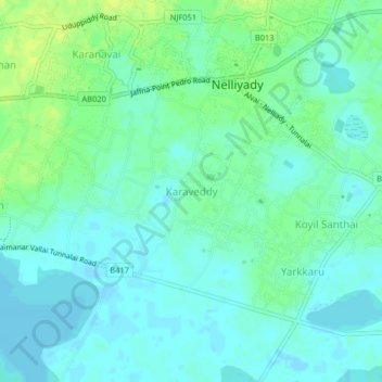
Name: Karaveddy topographic map, elevation, terrain.
Location: Karaveddy, Jaffna District, Northern Province, 40520, Sri Lanka (9.76800 80.17490 9.80800 80.21490)
Average elevation: 6 m
Minimum elevation: -3 m
Maximum elevation: 15 m
Thank you for supporting this site ❤️
Make a donation
Make a donation
Other topographic maps
Click on a map to view its topography, its elevation and its terrain.