
Trevignon topographic map
Interactive map
Click on the map to display elevation.
About this map
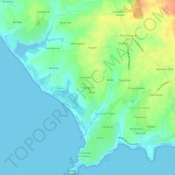
Name: Trevignon topographic map, elevation, terrain.
Average elevation: 12 m
Minimum elevation: -5 m
Maximum elevation: 41 m
Other topographic maps
Click on a map to view its topography, its elevation and its terrain.
Menhir du Château d'Eau
France > Bretagne > Finistère > Trégunc > Kerhallon Vian
Menhir du Château d'Eau, Rue Éric Tabarly, Kerhallon Vian, Trégunc, Quimper, Finistère, Bretagne, France métropolitaine, 29910, France
Average elevation: 36 m