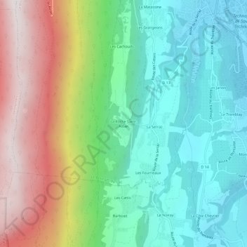
La Roche Saint-Alban topographic map
Interactive map
Click on the map to display elevation.
About this map
Name: La Roche Saint-Alban topographic map, elevation, terrain.
Average elevation: 666 m
Minimum elevation: 236 m
Maximum elevation: 1,473 m

Click on the map to display elevation.
Name: La Roche Saint-Alban topographic map, elevation, terrain.
Average elevation: 666 m
Minimum elevation: 236 m
Maximum elevation: 1,473 m