
Arjangarh Air Force Station topographic map
Interactive map
Click on the map to display elevation.
About this map
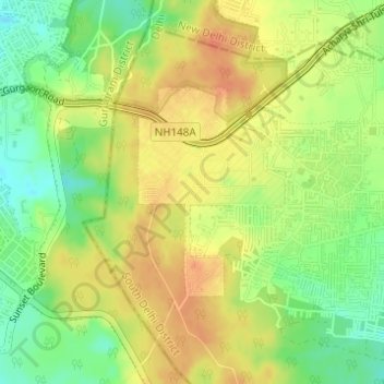
Name: Arjangarh Air Force Station topographic map, elevation, terrain.
Average elevation: 272 m
Minimum elevation: 248 m
Maximum elevation: 291 m
Other topographic maps
Click on a map to view its topography, its elevation and its terrain.
Children's (Chaudhary) park
India > Delhi > Mehrauli Tehsil > New Delhi
Children's (Chaudhary) park, Pkt-B Sec-A, New Delhi, Mehrauli Tehsil, South Delhi, Delhi, 110070, India
Average elevation: 265 m
Mehrauli
India > Delhi > Mehrauli Tehsil
Mehrauli, Mehrauli Tehsil, South Delhi, Delhi, 110030, India
Average elevation: 253 m