
Entable topographic map
Interactive map
Click on the map to display elevation.
About this map
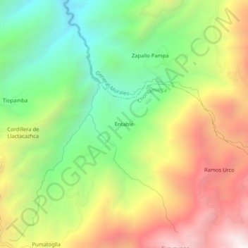
Name: Entable topographic map, elevation, terrain.
Location: Entable, Chontamarca, Cañar, Ecuador (-2.40552 -79.10514 -2.36552 -79.06514)
Average elevation: 2,078 m
Minimum elevation: 1,436 m
Maximum elevation: 2,874 m
Other topographic maps
Click on a map to view its topography, its elevation and its terrain.
Pumatoglla
Ecuador > Cañar > Cañar > Chontamarca
Pumatoglla, Chontamarca, Cañar, Ecuador
Average elevation: 2,136 m