
Le Bessaud topographic map
Interactive map
Click on the map to display elevation.
About this map
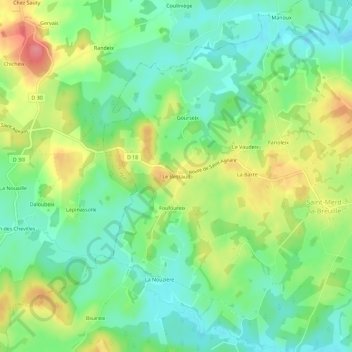
Name: Le Bessaud topographic map, elevation, terrain.
Average elevation: 765 m
Minimum elevation: 731 m
Maximum elevation: 820 m
Other topographic maps
Click on a map to view its topography, its elevation and its terrain.
Le Vaudeix
France > Nouvelle-Aquitaine > Creuse > Saint-Merd-la-Breuille
Le Vaudeix, Saint-Merd-la-Breuille, Aubusson, Creuse, Nouvelle-Aquitaine, France métropolitaine, 23100, France
Average elevation: 763 m
Bonnevialle
France > Nouvelle-Aquitaine > Creuse > Saint-Merd-la-Breuille
Bonnevialle, Saint-Merd-la-Breuille, Aubusson, Creuse, Nouvelle-Aquitaine, France métropolitaine, 23100, France
Average elevation: 755 m