
Thank you for supporting this site ❤️
Make a donation
Make a donation
Otter Rock topographic map
Click on the map to display elevation.
Thank you for supporting this site ❤️
Make a donation
Make a donation
About this map
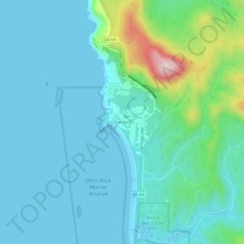
Name: Otter Rock topographic map, elevation, terrain.
Location: Otter Rock, Lincoln County, Oregon, 97369, United States (44.72719 -124.08036 44.76719 -124.04036)
Average elevation: 53 m
Minimum elevation: -2 m
Maximum elevation: 314 m
Thank you for supporting this site ❤️
Make a donation
Make a donation
Other topographic maps
Click on a map to view its topography, its elevation and its terrain.