
Свираны topographic map
Interactive map
Click on the map to display elevation.
About this map
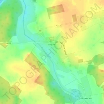
Name: Свираны topographic map, elevation, terrain.
Average elevation: 199 m
Minimum elevation: 179 m
Maximum elevation: 216 m
Other topographic maps
Click on a map to view its topography, its elevation and its terrain.
Жемчужный
Беларусь > Брестская область > Барановичский район > Жемчужненский сельский Совет
Жемчужный, Жемчужненский сельский Совет, Барановичский район, Брестская область, Беларусь
Average elevation: 192 m