
Osterne topographic map
Interactive map
Click on the map to display elevation.
About this map
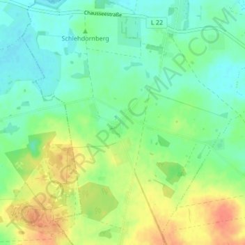
Name: Osterne topographic map, elevation, terrain.
Average elevation: 62 m
Minimum elevation: 46 m
Maximum elevation: 88 m
Other topographic maps
Click on a map to view its topography, its elevation and its terrain.
Kamp
Deutschland > Brandenburg > Oberhavel > Zehdenick
Kamp, Zehdenick, Oberhavel, Brandenburg, 16792, Deutschland
Average elevation: 48 m
Havel
Deutschland > Brandenburg > Oberhavel > Zehdenick
Havel, Zehdenick, Oberhavel, Brandenburg, 16792, Deutschland
Average elevation: 48 m