
Thank you for supporting this site ❤️
Make a donation
Make a donation
Dettelbach topographic map
Click on the map to display elevation.
Thank you for supporting this site ❤️
Make a donation
Make a donation
About this map
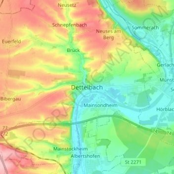
Name: Dettelbach topographic map, elevation, terrain.
Location: Dettelbach, Landkreis Kitzingen, Bayern, 97337, Deutschland (49.76227 10.12129 49.84227 10.20129)
Average elevation: 237 m
Minimum elevation: 183 m
Maximum elevation: 318 m
Thank you for supporting this site ❤️
Make a donation
Make a donation