
Thank you for supporting this site ❤️
Make a donation
Make a donation
Dripping Springs topographic map
Click on the map to display elevation.
Thank you for supporting this site ❤️
Make a donation
Make a donation
About this map
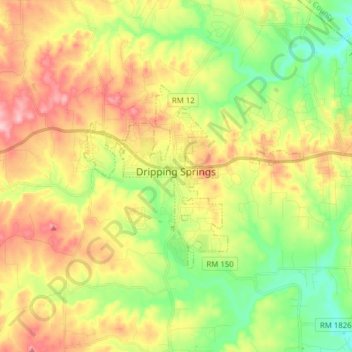
Name: Dripping Springs topographic map, elevation, terrain.
Location: Dripping Springs, Hays County, Texas, United States (30.15315 -98.12771 30.22337 -97.97198)
Average elevation: 356 m
Minimum elevation: 281 m
Maximum elevation: 446 m
Thank you for supporting this site ❤️
Make a donation
Make a donation
Other topographic maps
Click on a map to view its topography, its elevation and its terrain.