
Thank you for supporting this site ❤️
Make a donation
Make a donation
Geisengrund topographic map
Click on the map to display elevation.
Thank you for supporting this site ❤️
Make a donation
Make a donation
About this map
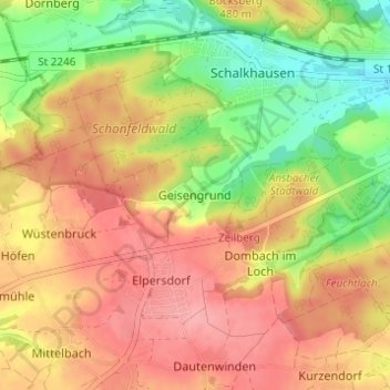
Name: Geisengrund topographic map, elevation, terrain.
Location: Geisengrund, Ansbach, Bayern, Deutschland (49.26774 10.50281 49.30774 10.54281)
Average elevation: 461 m
Minimum elevation: 406 m
Maximum elevation: 504 m
Thank you for supporting this site ❤️
Make a donation
Make a donation