
Eisborn topographic map
Interactive map
Click on the map to display elevation.
About this map
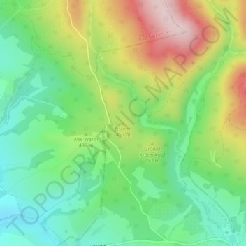
Name: Eisborn topographic map, elevation, terrain.
Average elevation: 416 m
Minimum elevation: 283 m
Maximum elevation: 633 m
Other topographic maps
Click on a map to view its topography, its elevation and its terrain.
Weißer Stein
Deutschland > Thüringen > Wartburgkreis > Bad Liebenstein
Weißer Stein, Bad Liebenstein, Wartburgkreis, Thüringen, 36448, Deutschland
Average elevation: 553 m