
Sous-le-Bois topographic map
Interactive map
Click on the map to display elevation.
About this map
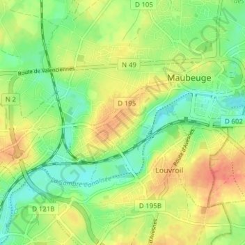
Name: Sous-le-Bois topographic map, elevation, terrain.
Average elevation: 146 m
Minimum elevation: 124 m
Maximum elevation: 170 m
Other topographic maps
Click on a map to view its topography, its elevation and its terrain.
Pont-Allant
France > Hauts-de-France > Nord > Maubeuge
Pont-Allant, Maubeuge, Avesnes-sur-Helpe, Nord, Hauts-de-France, France métropolitaine, 59600, France
Average elevation: 143 m