
Make a donation
Othonoi topographic map
Click on the map to display elevation.
Make a donation
Othonoi
At the beginning of the second millennium, the island was conquered alternatively by the Franks (the 11th century) and the Venetians (12th century), and often attacked by pirates of Barbary and Algeria. From the end of 1383 until 1386 the domination of Corfu was held by Charles III of Naples. In a letter from April 19, 1383, he granted the usufruct of Othonoi, Ereikoussa, Mathraki, Diapolo and Vido, to the knight Theodore Skaliti as fief. In 1537, the Turkish fleet under the command of Hayreddin Barbarossa massacred the inhabitants of Othoni island after a long battle. In Stavros district at an altitude of 217 m. a white stone cross exists until today to commemorate that event.
Make a donation
About this map
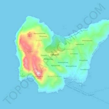
Name: Othonoi topographic map, elevation, terrain.
Average elevation: 49 m
Minimum elevation: 0 m
Maximum elevation: 371 m
Make a donation