
Tramizal topographic map
Interactive map
Click on the map to display elevation.
About this map
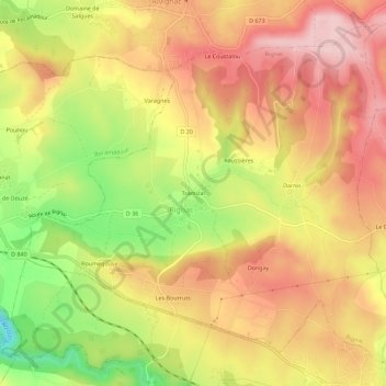
Name: Tramizal topographic map, elevation, terrain.
Average elevation: 330 m
Minimum elevation: 198 m
Maximum elevation: 422 m
Other topographic maps
Click on a map to view its topography, its elevation and its terrain.
Les Bourruts
France > Occitanie > Lot > Rignac
Les Bourruts, Rignac, Gourdon, Lot, Occitanie, France métropolitaine, 46500, France
Average elevation: 313 m
Roumegouse
France > Occitanie > Lot > Rignac
Roumegouse, Rignac, Gourdon, Lot, Occitanie, France métropolitaine, 46500, France
Average elevation: 304 m