
Carcóvia topographic map
Interactive map
Click on the map to display elevation.
About this map
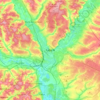
Name: Carcóvia topographic map, elevation, terrain.
Average elevation: 146 m
Minimum elevation: 92 m
Maximum elevation: 215 m
Other topographic maps
Click on a map to view its topography, its elevation and its terrain.
В'ялий
В'ялий, Циркунівська сільська громада, Харківський район, Oblast de Kharkiv, Ucrânia
Average elevation: 127 m