
Thank you for supporting this site ❤️
Make a donation
Make a donation
Mistberget topographic map
Click on the map to display elevation.
Thank you for supporting this site ❤️
Make a donation
Make a donation
About this map
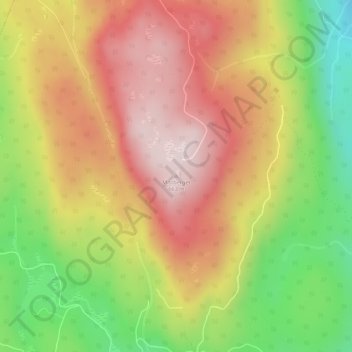
Name: Mistberget topographic map, elevation, terrain.
Location: Mistberget, Eidsvoll, Akershus, Norge (60.37496 11.15728 60.37506 11.15738)
Average elevation: 465 m
Minimum elevation: 227 m
Maximum elevation: 664 m
Thank you for supporting this site ❤️
Make a donation
Make a donation
Other topographic maps
Click on a map to view its topography, its elevation and its terrain.
Thank you for supporting this site ❤️
Make a donation
Make a donation
Thank you for supporting this site ❤️
Make a donation
Make a donation
Thank you for supporting this site ❤️
Make a donation
Make a donation
Thank you for supporting this site ❤️
Make a donation
Make a donation
Thank you for supporting this site ❤️
Make a donation
Make a donation