
Thank you for supporting this site ❤️
Make a donation
Make a donation
Lake Manitoba topographic map
Click on the map to display elevation.
Thank you for supporting this site ❤️
Make a donation
Make a donation
About this map
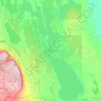
Name: Lake Manitoba topographic map, elevation, terrain.
Location: Lake Manitoba, Manitoba, Canada (50.18425 -99.57635 51.80771 -97.94669)
Average elevation: 298 m
Minimum elevation: 219 m
Maximum elevation: 749 m
Thank you for supporting this site ❤️
Make a donation
Make a donation