University Park topographic map
Click on the map to display elevation.
University Park
University Park was developed on land owned by the Deakins family since the mid-1700s. The house known as Deakins Hall or Bloomfield was constructed on the land in the 1820s or 1830s. It is located at 6404 Queens Chapel Road. The farm was purchased by the University Park Company in 1923. The extension of water and sewer lines into area at that time prompted the subdivision of the Deakins tract. The developers promised a community of single-family homes without the intrusion of commercial facilities. Restrictive covenants were placed on the deeds and all house plans had to be approved by the developers. Homebuyers were attracted to University Park due to its high elevation and lush vegetation. The developers also agreed to provide streetlights and trash removal for a 10-year period, and constructed a school in the mid-1920s.
About this map
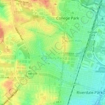
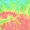
Name: University Park topographic map, elevation, terrain.
Average elevation: 29 m
Minimum elevation: 5 m
Maximum elevation: 57 m
Other topographic maps
Click on a map to view its topography, its elevation and its terrain.

Mount Rainier Community Food Forest
United States > Maryland > Prince George's County > Mount Rainier
Average elevation: 23 m

Sellman Estates
United States > Maryland > Prince George's County > Beltsville
Average elevation: 61 m
Mount Rainier Neighborhood Park
United States > Maryland > Prince George's County > Mount Rainier
Average elevation: 21 m
Farmington Road Estates
United States > Maryland > Prince George's County > Farmington Road Estates
Average elevation: 47 m