
镇巴县 topographic map
Interactive map
Click on the map to display elevation.
About this map
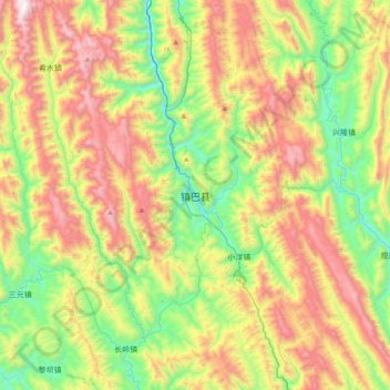
Name: 镇巴县 topographic map, elevation, terrain.
Location: 镇巴县, 汉中市, 陕西省, 中国 (32.37846 107.73113 32.69846 108.05113)
Average elevation: 1,215 m
Minimum elevation: 601 m
Maximum elevation: 2,115 m
Other topographic maps
Click on a map to view its topography, its elevation and its terrain.