
Thank you for supporting this site ❤️
Make a donation
Make a donation
Vilar topographic map
Click on the map to display elevation.
Thank you for supporting this site ❤️
Make a donation
Make a donation
About this map
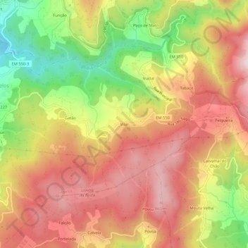
Name: Vilar topographic map, elevation, terrain.
Location: Vilar, Cepelos, Vale de Cambra, Aveiro, 3730-001, Portugal (40.81683 -8.33752 40.85683 -8.29752)
Average elevation: 657 m
Minimum elevation: 356 m
Maximum elevation: 883 m
Thank you for supporting this site ❤️
Make a donation
Make a donation