
Thank you for supporting this site ❤️
Make a donation
Make a donation
Gapyeong-eup topographic map
Click on the map to display elevation.
Thank you for supporting this site ❤️
Make a donation
Make a donation
About this map
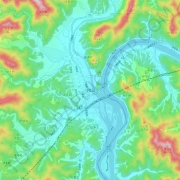
Name: Gapyeong-eup topographic map, elevation, terrain.
Location: Gapyeong-eup, Gapyeong-gun, 12419, South Korea (37.77415 127.45655 37.85415 127.53655)
Average elevation: 176 m
Minimum elevation: 43 m
Maximum elevation: 598 m
Thank you for supporting this site ❤️
Make a donation
Make a donation