
Grund topographic map
Interactive map
Click on the map to display elevation.
About this map
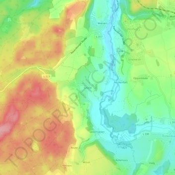
Name: Grund topographic map, elevation, terrain.
Average elevation: 677 m
Minimum elevation: 612 m
Maximum elevation: 760 m
Other topographic maps
Click on a map to view its topography, its elevation and its terrain.
Höfen
Deutschland > Baden-Württemberg > Landkreis Ravensburg > Vogt
Höfen, Vogt, Verwaltungsgemeinschaft Vogt, Landkreis Ravensburg, Baden-Württemberg, 88267, Deutschland
Average elevation: 690 m