
Bratislava topographic map
Interactive map
Click on the map to display elevation.
About this map
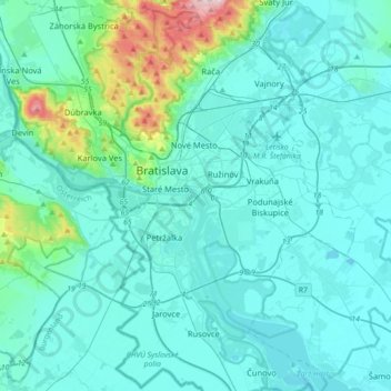
Name: Bratislava topographic map, elevation, terrain.
Location: Bratislava, Region of Bratislava, Slovakia (48.01789 16.96590 48.25455 17.24002)
Average elevation: 172 m
Minimum elevation: 118 m
Maximum elevation: 559 m