
Thank you for supporting this site ❤️
Make a donation
Make a donation
Beit Ummar topographic map
Click on the map to display elevation.
Thank you for supporting this site ❤️
Make a donation
Make a donation
About this map
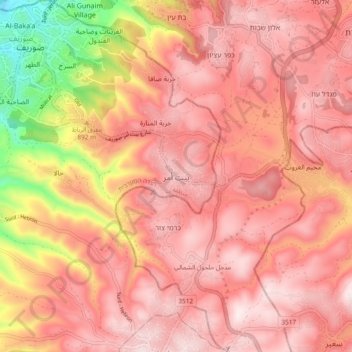
Name: Beit Ummar topographic map, elevation, terrain.
Location: Beit Ummar, Area B, West Bank, Palestinian Territory (31.58101 35.06309 31.66101 35.14309)
Average elevation: 845 m
Minimum elevation: 466 m
Maximum elevation: 1,013 m
Thank you for supporting this site ❤️
Make a donation
Make a donation
Other topographic maps
Click on a map to view its topography, its elevation and its terrain.