
Thank you for supporting this site ❤️
Make a donation
Make a donation
Fernão Ferro topographic map
Click on the map to display elevation.
Thank you for supporting this site ❤️
Make a donation
Make a donation
About this map
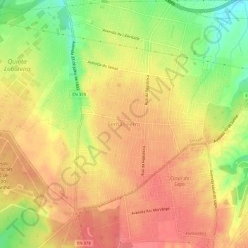
Name: Fernão Ferro topographic map, elevation, terrain.
Location: Fernão Ferro, Seixal, Setúbal, 2865-601, Portugal (38.54544 -9.11080 38.58544 -9.07080)
Average elevation: 61 m
Minimum elevation: 19 m
Maximum elevation: 84 m
Thank you for supporting this site ❤️
Make a donation
Make a donation
Other topographic maps
Click on a map to view its topography, its elevation and its terrain.