
Thank you for supporting this site ❤️
Make a donation
Make a donation
Lowndesboro topographic map
Click on the map to display elevation.
Thank you for supporting this site ❤️
Make a donation
Make a donation
About this map
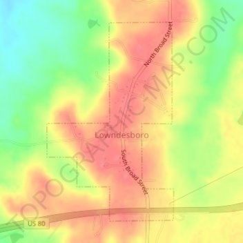
Name: Lowndesboro topographic map, elevation, terrain.
Location: Lowndesboro, Lowndes County, Alabama, United States (32.26554 -86.62121 32.28764 -86.60454)
Average elevation: 105 m
Minimum elevation: 64 m
Maximum elevation: 132 m
Thank you for supporting this site ❤️
Make a donation
Make a donation