
Darussalam topographic map
Interactive map
Click on the map to display elevation.
About this map
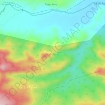
Name: Darussalam topographic map, elevation, terrain.
Location: Darussalam, Meurah Mulia, Aceh Utara, Aceh, Indonesia (4.94102 97.05252 4.98102 97.09252)
Average elevation: 159 m
Minimum elevation: 51 m
Maximum elevation: 373 m
Other topographic maps
Click on a map to view its topography, its elevation and its terrain.
Blang Panyang
Indonesia > Aceh > Aceh Utara > Blang Panyang
Blang Panyang, Nisam, Aceh Utara, Aceh, Indonesia
Average elevation: 53 m