
Bouillon topographic map
Interactive map
Click on the map to display elevation.
About this map
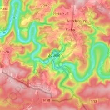
Name: Bouillon topographic map, elevation, terrain.
Location: Bouillon, Neufchâteau, Luxemburgo, Valonia, 6830, Bélgica (49.75498 5.02725 49.83498 5.10725)
Average elevation: 338 m
Minimum elevation: 195 m
Maximum elevation: 447 m